Engineering Geological Maps
Engineering geological maps frequently consist of basic geological maps on which some engineering geological data have been incorporated. Engineering geological maps and plans are used mainly for planning and civil engineering purposes. They provide planners and engineers with information which assists them in the planning of use of land, and the location, construction and maintenance of engineering structures of all types. Engineering geological maps are produced on the scale of 1:10000 or smaller whereas engineering geological plans, being produced for a particular engineering purpose, have a larger scale.
Types:
i. Analytical
ii. Comprehensive
Analytical maps provide details or evaluate individual components of the geological environment. Examples of such maps include those showing the degree of weathering or seismic hazard. Comprehensive maps either depict all the principal components of the engineering geological environment or are maps of engineering geological zoning, delineating individual territorial units on a basis of uniformity of the most significant attributes of their engineering geological characters.
The engineering geological report accompanying the engineering geological map should include following discussions and recommendations if any:
· Areas to be avoided if any and mitigation alternatives.
· Topography and slope.
· Stability of geologic units in the site
· Identification and extent of known or probable geologic conditions which may result in risk to the proposed land use (such as flood, surface- and groundwater pollution, snow avalanche, landslide, debris flow, rock fall, expansive soil, subsidence, erosion, earthquake shaking, fault, volcanic eruption etc.).
· Prediction of what materials and structural features will be encountered in proposed cuts.
· Excavation considerations (hard or massive rock, groundwater flows).
· General considerations of proposed fill masses in canyons or on side-hills.
· Suitability of on-site material for use as compacted fill.
· Recommendations concerning erosion protection on fill slopes.
· Other recommendations required by the proposed land use, such as the angle of cut slopes, position of drainage terraces, need for rock-fall and/or erosion protection on cut slopes.
· Protection from sheet flood or gully erosion, and debris flows or mud flows
· Recommendation for additional studies like boring, test pits and trenches, percolation tests and programmes for long-term monitoring of the site to evaluate geological conditions (survey hubs, inclinometers, extensometers etc.)
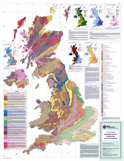
An example of an Engineering Geological Map
(The Engineering Geology Bedrock Map of the UK)
Source:
http://www.bgs.ac.uk/science/landUseAndDevelopment/engineering_geology/maps.html
